Orbital crop intelligence for commercial African agriculture.
TerraPulsee unifies multispectral satellite & drone blight detection (PhytoVision™), geospatial outgrower credit underwriting (OutgrowerSentinel™), and IoT weighbridge commodity escrow across 22 agro-estates and 48,500+ hectares.
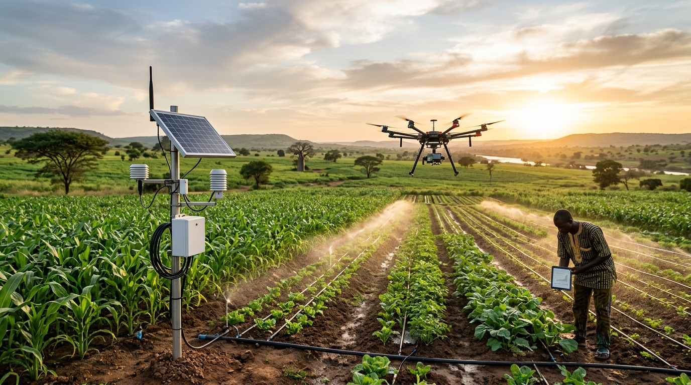
PhytoVision™ NDVI Alert • 99.2% Confidence
Fall Armyworm Instar-3 — Drone Spray BOQ ₦165,000 Locked
DJI Agras T40 unit dispatched • 420 Ha maize yield protected
The Commercial Agribusiness Bottleneck
Why outgrower schemes fail without geospatial verification.
Commercial flour mills, cocoa exporters, and agro-processors across Nigeria lose hundreds of millions of naira every season to undetected pest outbreaks, ghost farmer registries, and harvest side-selling.
Legacy Outgrower Operations
- 01Late Blight & Armyworm Discovery: Manual field scouting across thousands of hectares spots Fall Armyworm or Cocoa Black Pod only after 35% of the canopy is destroyed.
- 02Ghost Plots & Fertilizer Diversion: Paper-based outgrower lists contain overlapping or non-existent plots, resulting in 25–30% input loan defaults.
- 03Harvest Side-Selling at Farm Gate: Without satellite harvest window prediction and weighbridge escrow locks, contracted farmers sell produce to cash middlemen.
- 04EUDR Export Rejection Risk: European cocoa and soy buyers now reject shipments lacking verifiable polygon-level deforestation-free coordinates.
The TerraPulsee Autonomous OS
- ✓PhytoVision™ Early Blight Interception: Combines 5-day Sentinel-2 NDVI passes with offline smartphone leaf vision to trigger precision drone spraying 14 days before visible crop damage.
- ✓OutgrowerSentinel™ Polygon Underwriting: Verifies RTK-GPS farm boundaries, 5-year biomass history, and farmer BVN/NIN identities before releasing smart input vouchers.
- ✓HarvestEscrow™ Weighbridge Settlement: Connects directly to digital weighbridges to auto-deduct input loans and settle net USD/NGN proceeds in under 30 minutes.
- ✓100% EUDR Deforestation Passports: Generates cryptographic GeoJSON dossiers proving zero forest loss since 2020 for European commodity off-takers.
Seed-to-Silo Operational Pipeline
Four stages from polygon mapping to settled harvest escrow.
TerraPulsee connects satellite remote sensing, field extension officers, and commodity weighbridges into one tamper-proof ledger.
 01
Geofenced Polygon Mapping
Field agents walk plot perimeters with RTK-GPS tablets. OutgrowerSentinel eliminates polygon overlaps and audits 5-year Sentinel-2 deforestation & yield history.
 02
Smart Input Voucher Escrow
Underwritten farmers receive biometric smart-vouchers redeemable at vetted agro-dealers for IITA seed and NPK fertilizer—preventing cash diversion.
 03
PhytoVision™ Blight Triage
Multispectral satellite alerts and smartphone leaf macros classify pests in < 350ms, dispatching precision agricultural spray drones with verified BOQs.
 04
Weighbridge Off-Take Escrow
At harvest intake, digital weighbridges sync metric tonnage to HarvestEscrow, auto-deducting input loans and settling net farmer & exporter balances.
See how TerraPulsee eliminates crop blight & default risk in real time.
Test live multispectral leaf pathology triage, geospatial outgrower credit scoring, and regional harvest yield optimization across Nigerian agricultural belts.
Select Incoming Satellite / Drone Field Alert
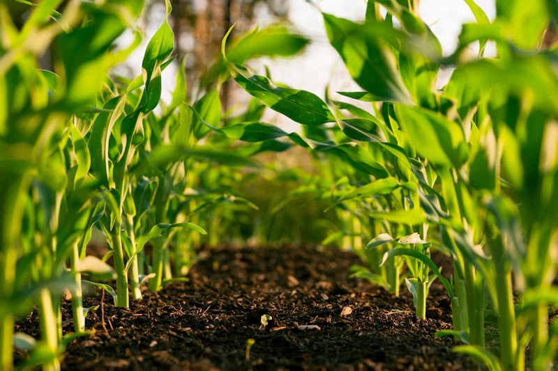
- Emamectin Benzoate 5% SG Bio-Selective Larvicide (6L): ₦78,000
- DJI Agras T40 Autonomous Drone Spot-Spray Flight (15 Ha): ₦52,000
- Foliar NPK + Micronutrient Recovery Booster: ₦35,000
AeroCrop Precision Spraying Unit #04 (Kaduna Hub)
< 3 hours field drone deployment
Geospatial & Edge AI Infrastructure
Powered by AWS, NVIDIA & Microsoft Azure.
Earth-observation satellite pipelines, GPU-accelerated multispectral vision, and sovereign commodity escrow vaults.
AWS Earth Search & KMS
AWS SageMaker Geospatial pipelines ingesting Sentinel-2 L2A & SAR radar tiles, plus AWS KMS hardware encryption for USD/NGN commodity escrow accounts.
NVIDIA TensorRT & Jetson
Sub-350ms leaf pathology segmentation on cloud NVIDIA L40S GPUs and edge-quantized inference for autonomous agricultural spray drones.
Azure Data Manager for Agri
Azure Confidential Computing enclaves for outgrower BVN/NIN solvency underwriting and immutable EUDR deforestation compliance ledgers.
Audited Agro-Estate & Exporter Results
Servicing commercial agro-estates & mills.
GreenBelt Agro-Allied & Outgrower Mills Ltd
“TerraPulsee’s Sentinel-2 NDVI alerts and PhytoVision drone triage saved over ₦290M in maize and soybean crops from Fall Armyworm across our Kaduna and Nasarawa corridors, while boosting input-loan recovery to 98.7%.”
Ondo Cocoa & Tree-Crop Export Consortium Ltd
“With European buyers enforcing strict EUDR deforestation rules, TerraPulsee mapped all 14,200 hectares of our Ondo cocoa blocks with GeoJSON proof and automated our USD/NGN weighbridge export escrow.”

Benue Valley Mechanized Rice & Grain REIT
“AgroYield’s SAR soil moisture telemetry and mechanized harvest scheduling increased our net paddy rice and cassava yield per hectare by 31% across Makurdi and Enugu agro-zones.”

Live Monitored Agro-Zones
Commercial plantations & outgrower belts under satellite lock.
From Kaduna irrigated maize plains to Ondo export cocoa forests and Benue river-basin rice estates, TerraPulsee tracks 48,500+ hectares every 5 days.
Zaria-Nasarawa Grain & Soy Corridor
Mechanized hybrid maize & industrial soybean blocks

Akure-Idanre EUDR Cocoa Belt
Export-grade fermented cocoa bean cooperatives

Makurdi Irrigated Paddy Rice Basin
River-basin commercial rice & cassava starch blocks

Nsukka-Adani High-Starch Cassava Cluster
Industrial ethanol & flour outgrower network
Executive Leadership
Built by agribusiness strategists & geospatial ML architects.
Headquartered at 3 Roseline Ezeka Street, Golf Estate, Enugu with field agronomy and remote-sensing operations across Nigeria’s major food belts.

Stephen Nzubechukwu A.
Institutional agribusiness executive and commodity value-chain strategist with deep experience structuring outgrower input-loan financing, EUDR export compliance, and automated weighbridge escrow across West Africa.
Leads TerraPulsee's partnerships across 22 commercial agro-estates, flour mills, and export cooperatives spanning 48,500+ hectares.

Adeleke Timothy
Geospatial machine learning researcher and remote-sensing computer vision architect with over a decade of experience engineering multispectral Sentinel-2/SAR pipelines, edge-quantized plant pathology models, and financial underwriting engines.
Architects TerraPulsee's PhytoVision™ (CropViT-MultiSpectral-v5) and OutgrowerSentinel™ (AgriCredit-GBM-v4) engines on AWS and NVIDIA TensorRT.
Commensurate Agribusiness B2B SaaS Tiers
Transparent pricing commensurate to cultivated hectares.
Generating ₦1.52M+ MRR across 22 commercial agro-estates and cooperatives—paying for itself in a single planting cycle by preventing blight and input-loan defaults.
Built for outgrower cooperatives and emerging commercial farms cultivating up to 1,500 hectares.
- Up to 1,500 geofenced hectares & 500 farmer profiles
- PhytoVision™ offline mobile leaf pathology triage
- Biometric agro-input smart-voucher disbursement
- Bi-weekly Sentinel-2 NDVI crop vigor summaries
Full satellite telemetry, drone spray dispatch, and weighbridge escrow for estates managing 1,500 to 10,000 hectares.
- Up to 10,000 hectares with 5-day Sentinel-2 & SAR passes
- Unlimited PhytoVision™ drone & mobile blight triage
- Full OutgrowerSentinel™ 5-year biomass credit underwriting
- HarvestEscrow™ digital weighbridge sync & loan recovery
- AgroYield™ micro-climatic harvest window forecasting
Custom architecture for export commodity aggregators, flour/rice mills, and agro-REITs managing 10,000+ hectares.
- Unlimited hectares, outgrowers & multi-state corridors
- 100% EUDR Deforestation GeoJSON export compliance dossiers
- Direct SAP Agribusiness, AFEX & IoT weighbridge webhooks
- Dedicated Lead Agronomist & Geospatial Solutions Engineer
Agronomic Due Diligence & FAQ
Answers for Estate Directors, Millers & Off-Takers.
Everything commercial farm directors, commodity exporters, and agricultural lenders need to know about deploying TerraPulsee.
Need custom shapefile/KML ingestion, EUDR cocoa polygon verification, or weighbridge integration? Reach out to stephen@terrapulsee.site or 08132262929.
TerraPulsee maps every outgrower plot with sub-meter RTK-GPS polygon boundaries and cross-checks historical Sentinel-2 and Landsat imagery back to December 2020. Each cocoa, soy, or oil-palm bag receives an immutable QR weighbridge passport proving zero deforestation.